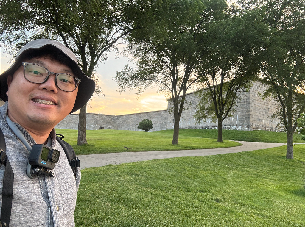
Search “Boston fishing” and Castle Island comes up first, every time. It sits on the outermost point of the harbor’s south side, under a five-pointed star fort — Fort Independence, the oldest continuously fortified English site in the United States. Fishing in the shadow of a fort that old has its own quiet pull.
The lay of the land
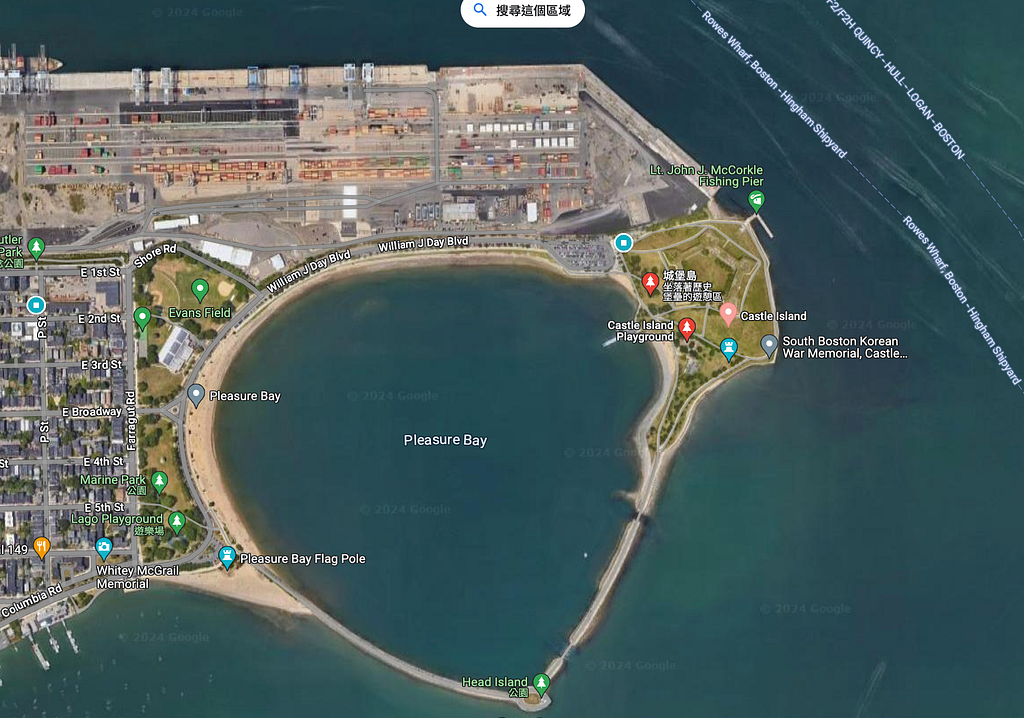
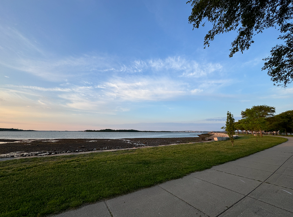
Castle Island itself is the green park on the eastern edge — a full tourist zone with easy access, a big parking lot, public restrooms, and a snack stand (well rated; I found it just okay). To the west is Pleasure Bay, an inner cove wrapped by an artificial causeway into something like a tidal lake. The Pleasure Bay beach is for swimming, not fishing — it’s just a man-made basin that breathes with the tide. Nobody works it seriously.
The spots that matter run north to south: the Lt. John J. McCorkle Fishing Pier, the flats in front of the Robert Greene Memorial, and Head Island with the two outflow gaps just north of it.
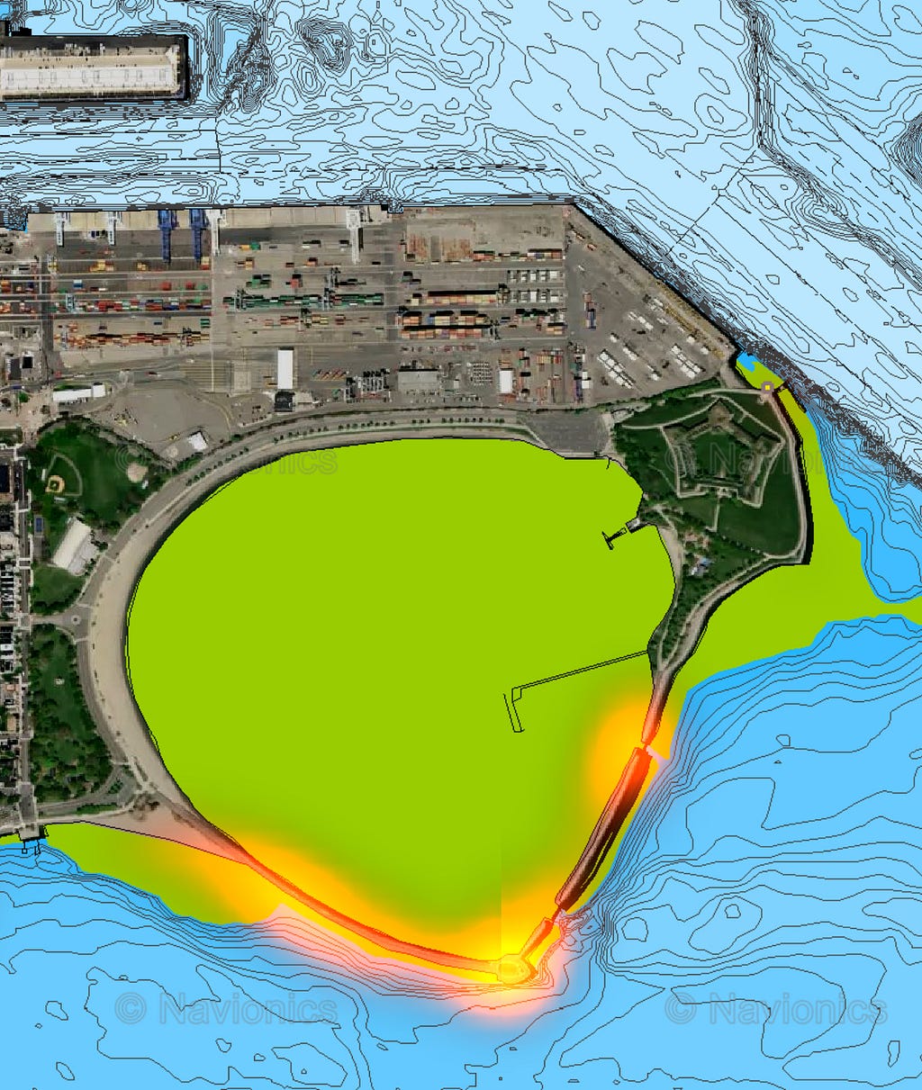
Why those three? The chart tells the story. The entire southeast face of Castle Island is shallow intertidal flat — green on the chart — and at low water it dries out into a wide cobble bank loaded with shellfish. Even if you walk out onto it, you’re better off wading further to reach water with any real depth.
McCorkle Pier — the best of the three
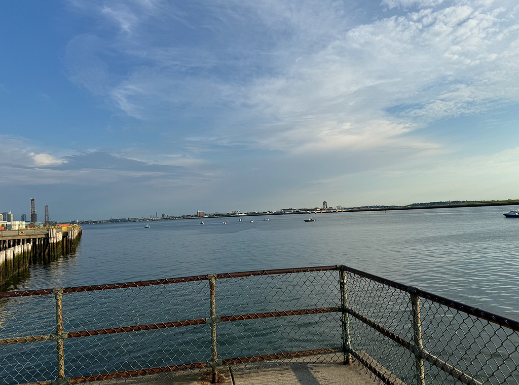
The northernmost spot, McCorkle Pier, butts straight onto the dredged main channel. A cast from here reaches the drop-off where the channel falls away — a genuine underwater cliff edge. The water is deep enough that you can fish it even at dead low. Footing is easy, the railing on the jutting deck sits about belly height so it doesn’t interfere much with working a lure. The one drawback is height: you’re a long way above the water, and landing a fish is the problem. The locals all carry a drop net — a Taiwanese angler would call it a 天網 — to scoop the fish and hoist it up flagpole-style. Without a net, if you hook anything with size, your only real shot is to walk it toward the entrance of the pier, where there’s a shallower patch, beach it on the shore with the swell, then climb over the railing from further back on the main island to go pick it up.
This is one of the spots where I actually saw striped bass from shore. A cluster of boats suddenly gathered about 200 meters north of the fishing pier — clearly something was going on out there — so I turned and threw toward them to test my luck. Right as I’d sent a cast long and was waiting for it to hit bottom, a mid-sized striper, maybe 50 cm, slid through the pilings directly beneath my feet. I cranked back as fast as I could and recast tight to the structure, but the fish was already gone. Nothing to show for it.
Robert Greene flats — a low-tide proposition
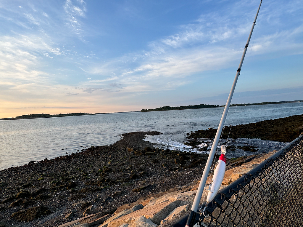
I first found the flats in front of the Robert Greene Memorial through a fly angler’s video. The cobble bank only surfaces on the dropping tide; in the clip the angler crosses it, then wades on in to waist depth before he even starts. For the whole Boston main channel this is a relatively slow back-eddy, and it’s a wide shelf rising sharply out of deep water — exactly the kind of structure where bait gets pinned and hunted when the fish are switched on.
When I got there I had no waders with me — I hadn’t packed them for the trip — and the water was only around 14°C. I could only walk to the front edge of the cobble and throw as far out as I could, but everything within casting range felt like under half a meter of water. And the kelp. Thick kelp, the heavy kind, fouling every single cast. I didn’t push it. I left the spot for a future trip when I’d have the right gear. But make no mistake — this is a low-tide spot.
The causeway and Head Island
Heading south you immediately hit the artificial causeway that rings Pleasure Bay. You can’t tell from the aerial, but both sides are fenced with wire, and the rock here is large, steep, and the section below the waterline looks viciously slick. Behind you there’s constant foot traffic — joggers and walkers. Fish it only with real care.
The more workable part of the causeway is Head Island and the two outflow gaps to its north. Head Island is a little plaza with a gazebo, benches, and a trash can; FishBrain shows plenty of catches logged here, including flatfish. There was bits of cut line and small litter on the ground. I arrived at low tide — the drop from the platform to the waterline at your feet was about two stories, and the riprap here isn’t the kind you climb down easily. Better to come around high water. Judging by the setup and the leftover fishing trash, this reads as a bottom-fishing hotspot. Lure anglers may want to mind their spacing, or just head straight to the two outflow gaps instead.
The outflow gaps
The causeway ringing Pleasure Bay has two breaks in it. These gaps let water flood into the bay on the rising tide and drain it back out on the fall. Beside each gap there’s a small spot you can climb out to from the railing and stand — a good ambush point, but high-water only. At low tide it looks like Head Island: another story of riprap to climb down to the cobble, then a long walk to the front edge. For safety I’d say don’t — the boulders that meet the water look genuinely slick, the kind you get down but can’t get back up.
Go back to that chart. The two gaps also sit right against the drop-off, and they have moving water pushing through them with every tide. It isn’t hard to see why this would fish. It’s also one of FishBrain’s AI-predicted hotspots — worth putting some time in here to verify for yourself.
Castle Island is probably the most legible shore mark I’ve fished — chart, aerial, FishBrain, all of it lines up and tells you exactly where the depth is, where the current pushes, what the tide unlocks. The irony of a spot that well-documented is that it also tells you precisely what you’re missing: the right gear, the right phase, the right window. No waders, 14°C water, and a cobble flat I could see but couldn’t reach. The information was all there. Next time, so will the equipment.